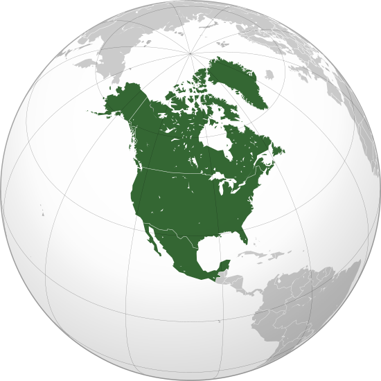
Mynd:North America (orthographic projection).svg

Size of this PNG preview of this SVG file: 550 × 550 pixels. Aðrar upploysnir: 240 × 240 pixels | 480 × 480 pixels | 768 × 768 pixels | 1.024 × 1.024 pixels | 2.048 × 2.048 pixels.
Upprunafíla (SVG fíle, nominelt 550 × 550 pixel, fíle stødd: 457 KB)
Samandráttur
| Frágreiðing |
বাংলা: ওত্তরী আমেরিকার অর্থোগ্রাফিক মানচিত্র हिन्दी: उत्तरी अमेरिका का लेखनप्रक्षेपीय मानचित्र English: North America (orthographic projection) |
||||
| Dagur | |||||
| Kelda |
Egið verk (Original text: Own work,)
|
||||
| Høvundur | Heraldry | ||||
| Loyvi (Endurnýtsla av hesi fílu) |
|
||||
| Other versions |
Derivative works of this file: BK North America (orthographic projection).png .svg) |
||||
| SVG genesis | SVG watermarked with invisible embedded text. |

.svg)
.svg)
.svg)
.svg)
.svg)
.svg)
.svg)
.svg)
.svg)
.svg)
.svg)
.svg)
.svg)
.svg)
.svg)
.svg)
.svg)
.svg)
.svg)
.svg)
.svg)
.svg)
.svg)
.svg)
.svg)
.svg)
.svg)
.svg)
.svg)
.svg)
.svg)
.svg)
.svg)
.svg)
.svg)
.svg)
.svg)
.svg)
.svg)
.svg)
.svg)
.svg)
.svg)
.svg)
.svg)
.svg)
.svg)
.svg)
.svg)
.svg)
.svg)
.svg)
.svg)
.svg)
.svg)
.svg)
.svg)
.svg)
.svg)
.svg)
.svg)
.svg)
.svg)
.svg)
.svg)
.svg)
.svg)
.svg)
.svg)
.svg)
.svg)
.svg)
.svg)

.svg)

.svg)

.svg)
.svg)
.svg)
.svg)
.svg)
.svg)
.svg)


.svg)
.svg)
.svg)
.svg)
.svg)
.svg)
.svg)

.svg)
.svg)
.svg)
.svg)
.svg)
.svg)
.svg)
.svg)
.svg)

.svg)
.svg)
.svg)
.svg)
.svg)
.svg)
.svg)
_without_national_boundaries.svg)
.svg)
.svg)
.svg)
.svg)
.svg)
.svg)

.svg)
.svg)
.png)
.svg)
.svg)
.svg)
.svg)

.svg)
.svg)
.svg)
.svg)
.svg)
.svg)
.svg)
.svg)
.svg)
.svg)
.svg)

.svg)
.svg)
.svg)
.svg)
.svg)
.svg)
.svg)
.svg)
.svg)

.svg)
.svg)

.svg)
.svg)
.svg)
.svg)
.svg)
.svg)
.svg)
.svg)
.svg)
.svg)
.svg)
.svg)
.svg)
.svg)
.svg)
.svg)
.svg)
.svg)
.svg)
.svg)
.svg)
.svg)
.svg)
.svg)
.svg)
.svg)
.svg)
_-_Crimea_disputed.svg)
.svg)
.svg)
.svg)
.svg)
.svg)
.svg)
.svg)
.svg)
.svg)
.svg)
.svg)
_political.svg)
.svg)
.svg)
.svg)
.svg)
_-_Crimea_disputed_-_no_borders.svg)
.svg)
.svg)
.svg)
.svg)
.svg)
.svg)
.svg)
.svg)
.svg)
.svg)
.svg)

.svg)
.svg)
.svg)

.png)
.svg)
.svg)
.svg)
.svg)
.svg)
.svg)
.svg)
.svg)
.svg)
.svg)
.svg)
.svg)
.svg)
.svg)
.svg)
.svg)
.svg)
.svg)
.svg)
.svg)
.svg)
.svg)
.svg)
.svg)
.svg)
.svg)
.svg)
.svg)
.svg)
.svg)
.svg)
.svg)
.svg)
.svg)
.png)
.svg)
.svg)
.svg)
_(orthographic_projection).png)
.svg)
.png)
.svg)
.svg)
.svg)
.svg)
Lisensur
I, the copyright holder of this work, hereby publish it under the following license:

|
Loyvi verður givi at avrita, bera út og/ella broyta hetta skjal undir treytunum hjá GNU Free Documentation License, versión 1.2 ella einhvør seinni versjón ið er útgivin av Free Software Foundation; uttan nakað óbroytiligt brot, uttan forsíðutekst og uttan baksíðutekst. Eitt avrit av loyvinum er tikið við í brotinum ið nevnist GNU Free Documentation License. |
| Henda fíla er gjørd atkomulig undir Creative Commons Navngev-Deil á sama hátt 3.0 Unported loyvinum. | ||
| ||
| This licensing tag was added to this file as part of the GFDL licensing update. |
Søgan hjá fíluni
Trýst á dato/tíð fyri at síggja fíluna, sum hon sá út tá.
| Dagur/Tíð | Lítil mynd | Dimensjónir | Brúkari | Viðmerking | |
|---|---|---|---|---|---|
| streymur | 27. jun 2023 kl. 08:38 | | 550 × 550 (457 KB) | Lasunncty | Reverted to version as of 16:06, 17 January 2023 (UTC) duplicate |
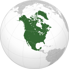
| 25. jun 2023 kl. 19:49 |  | 550 × 550 (455 KB) | HelpfulHens | Central America and the Caribbean are all part of North America | |
| 17. jan 2023 kl. 16:06 |  | 550 × 550 (457 KB) | Bultro | the map with all Mexico and Caribbean is file:Location North America.svg. We just also want THIS map. You may ask to rename it | |
| 8. jan 2023 kl. 22:28 |  | 550 × 550 (414 KB) | HelpfulHens | Added Central America and the Caribbean | |
| 8. jan 2023 kl. 22:16 |  | 550 × 550 (457 KB) | Bultro | the map without Mexico is File:Northern America (orthographic projection).svg | |
| 7. jan 2023 kl. 17:33 |  | 550 × 550 (676 KB) | HelpfulHens | Removed Mexico | |
| 7. sep 2009 kl. 16:42 |  | 550 × 550 (457 KB) | TownDown | sized according | |
| 10. jul 2009 kl. 08:52 |  | 541 × 541 (457 KB) | PuebloUnited | details | |
| 25. jun 2009 kl. 08:23 |  | 541 × 541 (458 KB) | TownDown | {{Information |Description={{en|1=North America}} |Source=trabajo propio (own work) |Author=TownDown |Date= |Permission= |other_versions= }} <!--{{ImageUpload|full}}--> Category:Orthographic projections |
Myndarslóðir
Hesar síður slóða til hesa mynd:
- Amerikonsku Jómfrúoyggjar
- Anguilla
- Antigua og Barbuda
- Aruba
- Bahamaoyggjar
- Barbados
- Belis
- Bermuda
- Caymanoyggjar
- Dominika
- Dominikanalýðveldið
- El Salvador
- Grenada
- Grønland
- Guadeloupe
- Guatemala
- Haiti
- Honduras
- Jamaika
- Kanada
- Kosta Rika
- Kuba
- Martinique
- Meksiko
- Montserrat
- Nikaragua
- Panama
- Puerto Riko
- Saint-Pierre og Miquelon
- St. Kitts og Nevis
- St. Lusia
- St Vinsent og Grenadinoyggjar
- Trinidad og Tobago
- Turks- og Caicosoyggjar
- USA
- Fyrimynd:Norðuramerika
Alheims fílunýtsla
Aðrar wkiir brúka hesa fílu:
- Nýtsla á af.wikipedia.org
- Noord-Amerika
- Verenigde State van Amerika
- Kaaimanseilande
- Kanada
- Ottawa
- Groenland
- Sint Pierre en Miquelon
- Hoofstad
- Lys van hoofstede
- Meksiko
- Aruba
- Oranjestad
- Kategorie:Lande in Noord-Amerika
- Sint Maarten
- Kuba
- Washington, D.C.
- Lys van lande
- Puerto Rico
- Havana
- Costa Rica
- Honduras
- Belize
- Guatemala
- El Salvador
- Nicaragua
- Panama
- Jamaika
- St. Lucia
- San José, Costa Rica
- Tegucigalpa
- San Salvador
- Castries
- Barbados
- Lys van nasionale leuses
- Sjabloon:Lande van Noord-Amerika
- Sjabloon:Lande van Amerika
- Clipperton
- Dominikaanse Republiek
- Meksikostad
- Amerikas
- Sjabloon:Hoofstede in Noord-Amerika
- Bahamas
- Haïti
- Antigua en Barbuda
- Trinidad en Tobago
- Dominica
- Grenada
- St. Kitts en Nevis
- St. Vincent en die Grenadine
- Belmopan
Vís meiri globala nýtslu av hesi fílu.
.svg)
.svg)