Mynd:Outer Hebrides UK relief location map.jpg

Stødd av hesi forskoðan: 456 × 600 pixels. Aðrar upploysnir: 182 × 240 pixels | 365 × 480 pixels | 584 × 768 pixels | 778 × 1.024 pixels | 2.001 × 2.632 pixels.
Upprunafíla (2.001 × 2.632 pixel, stødd fílu: 481 KB, MIME-slag: image/jpeg)
| Frágreiðing |
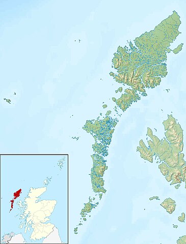
Relief map of the Outer Hebrides (excluding Sula Sgeir), UK. Equirectangular map projection on WGS 84 datum, with N/S stretched 180% Geographic limits:
|
| Dagur | |
| Kelda |
|
| Høvundur | Nilfanion, created using Ordnance Survey data |
| Loyvi (Endurnýtsla av hesi fílu) |
Henda fíla er gjørd atkomulig undir Creative Commons Navngev-Deil á sama hátt 3.0 Unported loyvinum. Ognan: Contains Ordnance Survey data © Crown copyright and database right
|
| Other versions | File:Outer Hebrides UK blank map.svg - Blank map |
Søgan hjá fíluni
Trýst á dato/tíð fyri at síggja fíluna, sum hon sá út tá.
| Dagur/Tíð | Lítil mynd | Dimensjónir | Brúkari | Viðmerking | |
|---|---|---|---|---|---|
| streymur | 30. nov 2011 kl. 12:26 | | 2.001 × 2.632 (481 KB) | Nilfanion | {{Information |Description=Relief map of the Outer Hebrides (excluding Sula Sgeir), UK. Equirectangular map projection on WGS 84 datum, with N/S stretched 180% Geographic limits: *West: 8.70W *East: 6.10W *North: 58 |
Myndarslóðir
Hesar síður slóða til hesa mynd:
Alheims fílunýtsla
Aðrar wkiir brúka hesa fílu:
- Nýtsla á ar.wikipedia.org
- Nýtsla á bg.wikipedia.org
- Nýtsla á ceb.wikipedia.org
- Nýtsla á da.wikipedia.org
- Nýtsla á de.wikipedia.org
- Soay (St. Kilda)
- Hirta
- Uist
- Boreray (St. Kilda)
- Uig (Lewis)
- Dùn
- North Rona
- Sula Sgeir
- Stac Lee
- Stac an Armin
- Barra Head (Schottland)
- Loch Druidibeag
- Lewis and Harris
- Seaforth Island
- Haskeir
- Vorlage:Positionskarte Schottland Outer Hebrides
- Stiaraval
- Ruaval
- Heaval
- Ben Tangaval
- Beinn Sciathan
- Eriskay-Sund
- Acairseid Mhor
- Berneray-Sund
- Loch Borve
- Loch Beag Bhuirgh
- Loch Bhrusda
- Borve Hill
- Beinn Shleibhe
- Loch Seaforth
- Loch Odhairn
- Scarp
- Fladday
- Sound of Scarp
- Loch Langavat
- Mealasta
- Little Bernera
- Flodaigh
- Flodaigh (Bernera)
- Bearasay
- Seanna Chnoc
- Kealasay
- Campay
- Craigeam
Vís meiri globala nýtslu av hesi fílu.