Mynd:Ukraine under russian occupation.svg

Size of this PNG preview of this SVG file: 800 × 538 pixels. Aðrar upploysnir: 320 × 215 pixels | 640 × 430 pixels | 1.024 × 688 pixels | 1.280 × 860 pixels | 2.560 × 1.720 pixels | 3.780 × 2.540 pixels.
Upprunafíla (SVG fíle, nominelt 3.780 × 2.540 pixel, fíle stødd: 1,36 MB)
Samandráttur
| Frágreiðing |
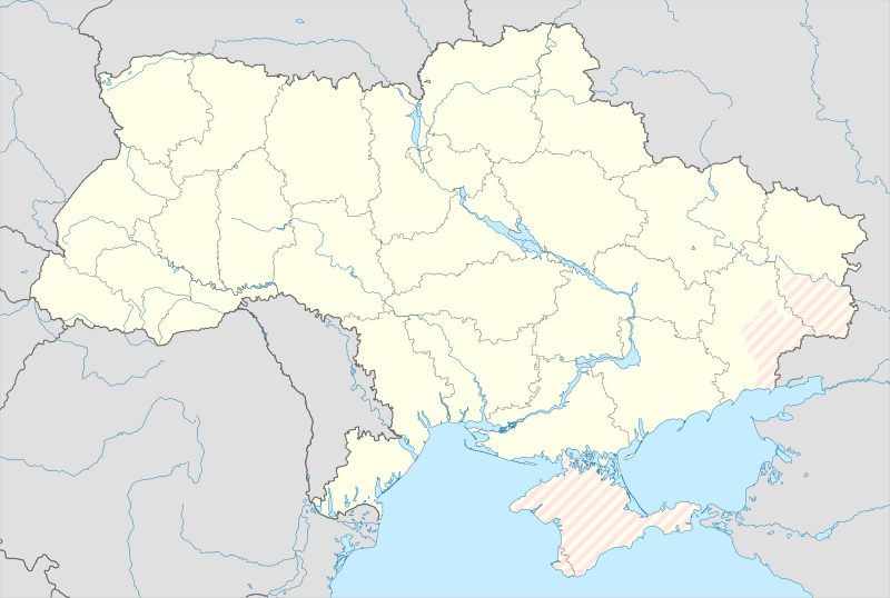
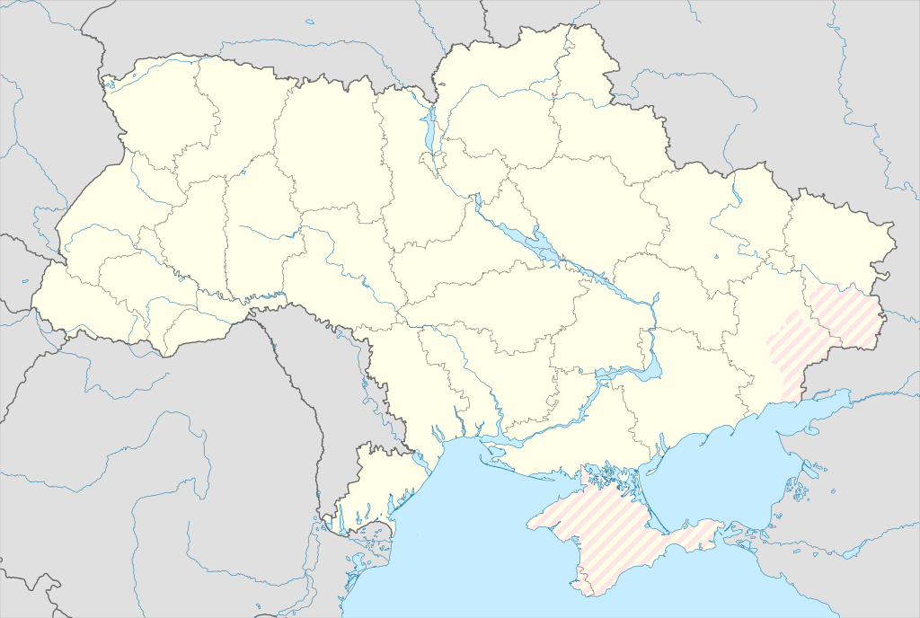
English: Location map of Ukraine under russian occupation.
Українська: Карта України з зонами російської окупації. |
| Dagur | |
| Kelda |
Own work using: Ukraine adm location map improved.svg, according to
|
| Høvundur | Yakiv Gluck |
| Other versions |
|
| SVG genesis | This locator map was created with Adobe Illustrator. |


Lisensur
I, the copyright holder of this work, hereby publish it under the following license:
This file is licensed under the Creative Commons Attribution-Share Alike 4.0 International license.
- Tú ert vælkomin til:
- at deila – at avrita, breiða út og senda verkið
- at remiksa – at tillaga ella broyta verkið
- Undir hesum treytum:
- ognan – Tú mást ognarskrivað verkið á ein slíkan hátt sum er útgreinaður av høvundanum ella lisenseigaranum (men ikki á nakran hátt ið kundi bent á at hesin hevur góðkent teg ella tína nýtslu av verkinum).
- deil undir somu treytum – Um tú broytir, evnar til ella byggir víðari á hetta verk, so kanst tú bert útgeva verkið undir somu ella líkandi lisensi sum hesin.
Søgan hjá fíluni
Trýst á dato/tíð fyri at síggja fíluna, sum hon sá út tá.
| Dagur/Tíð | Lítil mynd | Dimensjónir | Brúkari | Viðmerking | |
|---|---|---|---|---|---|
| streymur | 9. aug 2023 kl. 15:45 | | 3.780 × 2.540 (1,36 MB) | Dƶoxar | Until the war ends it has no sense to maintain another map with actual frontline |
| 25. jul 2023 kl. 09:32 |  | 3.780 × 2.540 (1,64 MB) | ASDFPM | Reverted to version as of 17:17, 3 October 2022 (UTC) | |
| 12. nov 2022 kl. 02:45 |  | 3.780 × 2.540 (1,36 MB) | Qexypnos | Reverted to version as of 17:02, 3 March 2018 (UTC) | |
| 3. okt 2022 kl. 17:17 |  | 3.780 × 2.540 (1,64 MB) | Janitoalevic | Update | |
| 3. mar 2018 kl. 17:02 |  | 3.780 × 2.540 (1,36 MB) | Yakiv Gluck | improved using new adm loc map | |
| 27. jan 2018 kl. 01:08 |  | 1.546 × 1.038 (457 KB) | Yakiv Gluck | {{Information |Description ={{en|Location map of Ukraine under russian occupation.}} {{uk|Карта України з зонами російської окупації.}} |Source =own work, using [[:F... |
Myndarslóðir
Ongar síður slóða til hesa myndina.
Alheims fílunýtsla
Aðrar wkiir brúka hesa fílu:
- Nýtsla á an.wikipedia.org
- Nýtsla á de.wikipedia.org
- Nýtsla á en.wikipedia.org
- Nýtsla á es.wikipedia.org
Vís meiri globala nýtslu av hesi fílu.