Mynd:USA California location map.svg

Size of this PNG preview of this SVG file: 523 × 599 pixels. Aðrar upploysnir: 209 × 240 pixels | 419 × 480 pixels | 670 × 768 pixels | 894 × 1.024 pixels | 1.787 × 2.048 pixels | 1.022 × 1.171 pixels.
Upprunafíla (SVG fíle, nominelt 1.022 × 1.171 pixel, fíle stødd: 480 KB)
Samandráttur
| Frágreiðing |
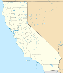
Quadratische Plattkarte, N-S-Streckung 125 %. Geographische Begrenzung der Karte:
Equirectangular projection, N/S stretching 125 %. Geographic limits of the map:
|
||
| Dagur | |||
| Kelda |
Egið verk
|
||
| Høvundur | NordNordWest | ||
| Other versions |
Derivative works of this file: |
||
| SVG genesis |
|

Lisensur
I, the copyright holder of this work, hereby publish it under the following licenses:

|
Loyvi verður givi at avrita, bera út og/ella broyta hetta skjal undir treytunum hjá GNU Free Documentation License, versión 1.2 ella einhvør seinni versjón ið er útgivin av Free Software Foundation; uttan nakað óbroytiligt brot, uttan forsíðutekst og uttan baksíðutekst. Eitt avrit av loyvinum er tikið við í brotinum ið nevnist GNU Free Documentation License. |
This file is licensed under the Creative Commons Attribution 3.0 Unported license.
- Tú ert vælkomin til:
- at deila – at avrita, breiða út og senda verkið
- at remiksa – at tillaga ella broyta verkið
- Undir hesum treytum:
- ognan – Tú mást ognarskrivað verkið á ein slíkan hátt sum er útgreinaður av høvundanum ella lisenseigaranum (men ikki á nakran hátt ið kundi bent á at hesin hevur góðkent teg ella tína nýtslu av verkinum).
Tú kanst velja tann lisens ið tú ynskir.
Søgan hjá fíluni
Trýst á dato/tíð fyri at síggja fíluna, sum hon sá út tá.
| Dagur/Tíð | Lítil mynd | Dimensjónir | Brúkari | Viðmerking | |
|---|---|---|---|---|---|
| streymur | 5. jun 2009 kl. 19:17 | | 1.022 × 1.171 (480 KB) | NordNordWest | more detailed |
| 12. mar 2009 kl. 21:50 |  | 1.020 × 1.169 (385 KB) | NordNordWest | {{Information |Description= {{de|Positionskarte von Kalifornien, USA}} Quadratische Plattkarte, N-S-Streckung 125 %. Geographische Begrenzung der Karte: * N: 42.2° N * S: 32.3° N * W: 124.7° W * O: 113.9° W {{en|Locatio |
Myndarslóðir
Hesar síður slóða til hesa mynd:
Alheims fílunýtsla
Aðrar wkiir brúka hesa fílu:
- Nýtsla á af.wikipedia.org
- Nýtsla á als.wikipedia.org
- Nýtsla á an.wikipedia.org
- Nýtsla á ar.wikipedia.org
- يونيفرسال سيتي
- قالب:ص.م/موقع جغرافي متعدد
- قالب:خريطة مواقع الولايات المتحدة/كاليفورنيا
- قالب:ص.م/موقع جغرافي متعدد/شرح
- مطار رينو تاهو الدولي
- خطوط الاسكا الجوية الرحلة 261
- برج ليليان كويت
- حادثة إطلاق النار بمطار لوس أنجلوس الدولي 2002
- قصر وينشستر الغامض
- زلزال نورثريدج 1994
- زامبيريني فيلد
- قالب:ص.م/موقع جغرافي متعدد/ملعب
- Nýtsla á ast.wikipedia.org
- Aeropuertu Internacional de Los Angeles
- Aeropuertu de Long Beach
- Aeropuertu Internacional d'Oakland
- Aeropuertu Internacional LA/Ontario
- Aeropuertu Internacional de Sacramento
- Aeropuertu Públicu de Santa María
- Módulu:Mapa de llocalización/datos/California
- Módulu:Mapa de llocalización/datos/California/usu
- Nýtsla á azb.wikipedia.org
Vís meiri globala nýtslu av hesi fílu.