Mynd:Scotland relief location map.jpg

Stødd av hesi forskoðan: 456 × 600 pixels. Aðrar upploysnir: 182 × 240 pixels | 365 × 480 pixels | 584 × 768 pixels | 1.128 × 1.483 pixels.
Upprunafíla (1.128 × 1.483 pixel, stødd fílu: 927 KB, MIME-slag: image/jpeg)
Samandráttur
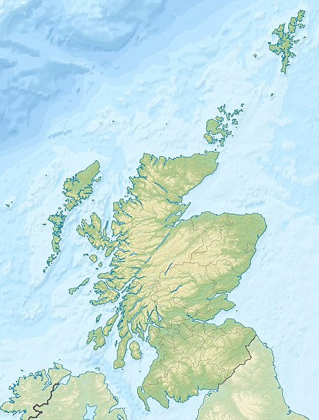
| Frágreiðing | Quadratische Plattkarte, N-S-Streckung 170 %. Geographische Begrenzung der Karte: * N: 61.0° N * S: 54.5° N * W: 8.8° W * O: 0.4° W Equirectangular projection, N/S stretching 170 %. Geographic limits of the map: * N: 61.0° N * S: 54.5° N * W: 8.8° W * E: 0.4° W |
| Dagur | (UTC) |
| Kelda | Egið verk |
| Høvundur |
|
| Other versions |
|

Lisensur
I, the copyright holder of this work, hereby publish it under the following licenses:
Henda fíla er gjørd atkomulig undir Creative Commons Navngev-Deil á sama hátt 3.0 Unported loyvinum.
Ognan: Eric Gaba, NordNordWest, Uwe Dedering
- Tú ert vælkomin til:
- at deila – at avrita, breiða út og senda verkið
- at remiksa – at tillaga ella broyta verkið
- Undir hesum treytum:
- ognan – Tú mást ognarskrivað verkið á ein slíkan hátt sum er útgreinaður av høvundanum ella lisenseigaranum (men ikki á nakran hátt ið kundi bent á at hesin hevur góðkent teg ella tína nýtslu av verkinum).
- deil undir somu treytum – Um tú broytir, evnar til ella byggir víðari á hetta verk, so kanst tú bert útgeva verkið undir somu ella líkandi lisensi sum hesin.

|
Loyvi verður givi at avrita, bera út og/ella broyta hetta skjal undir treytunum hjá GNU Free Documentation License, versión 1.2 ella einhvør seinni versjón ið er útgivin av Free Software Foundation; uttan nakað óbroytiligt brot, uttan forsíðutekst og uttan baksíðutekst. Eitt avrit av loyvinum er tikið við í brotinum ið nevnist GNU Free Documentation License. |
Tú kanst velja tann lisens ið tú ynskir.
Original upload log
This image is a derivative work of the following images:
- File:Scotland_location_map.svg licensed with Cc-by-sa-3.0, GFDL
- 2008-10-09T18:27:35Z NordNordWest 1128x1483 (829918 Bytes) {{Information |Description= {{de|Positionskarte von [[:de:Schottland|Schottland]], [[:de:Vereinigtes Königreich|Vereinigtes Königreich]]}} Quadratische Plattkarte, N-S-Streckung 170 %. Geographische Begrenzung der Karte: *
Uploaded with derivativeFX
Søgan hjá fíluni
Trýst á dato/tíð fyri at síggja fíluna, sum hon sá út tá.
| Dagur/Tíð | Lítil mynd | Dimensjónir | Brúkari | Viðmerking | |
|---|---|---|---|---|---|
| streymur | 25. jun 2010 kl. 23:30 | | 1.128 × 1.483 (927 KB) | Uwe Dedering | {{Information |Description={{de|Positionskarte von Schottland, Vereinigtes Königreich}} Quadratische Plattkarte, N-S-Streckung 170 %. Geographische Begrenzung der Karte: * N: 61.0° N * S: 54.5° N * W: |
Myndarslóðir
Hesar síður slóða til hesa mynd:
Alheims fílunýtsla
Aðrar wkiir brúka hesa fílu:
- Nýtsla á ab.wikipedia.org
- Nýtsla á am.wikipedia.org
- Nýtsla á ar.wikipedia.org
- Nýtsla á arz.wikipedia.org
- Nýtsla á ast.wikipedia.org
- Nýtsla á as.wikipedia.org
- Nýtsla á awa.wikipedia.org
- Nýtsla á azb.wikipedia.org
- Nýtsla á az.wikipedia.org
- Nýtsla á ba.wikipedia.org
- Nýtsla á be-tarask.wikipedia.org
- Nýtsla á be.wikipedia.org
Vís meiri globala nýtslu av hesi fílu.