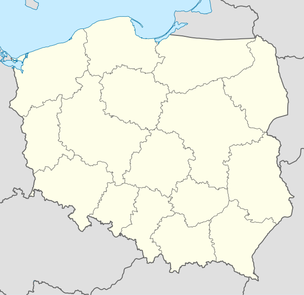
Mynd:Poland location map.svg

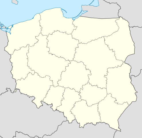
Size of this PNG preview of this SVG file: 617 × 600 pixels. Aðrar upploysnir: 247 × 240 pixels | 494 × 480 pixels | 790 × 768 pixels | 1.053 × 1.024 pixels | 2.107 × 2.048 pixels | 861 × 837 pixels.
Upprunafíla (SVG fíle, nominelt 861 × 837 pixel, fíle stødd: 213 KB)
Samandráttur
| Frágreiðing |
Deutsch: Positionskarte von Polen
Quadratische Plattkarte, N-S-Streckung 160 %. Geographische Begrenzung der Karte:
English: Location map of Poland
Equirectangular projection, N/S stretching 160 %. Geographic limits of the map:
|
||
| Dagur | |||
| Kelda |
Egið verk using
|
||
| Høvundur | NordNordWest | ||
| Other versions |
|
||
| SVG genesis | This W3C-invalid map was created with Adobe Illustrator.
|


Lisensur
I, the copyright holder of this work, hereby publish it under the following licenses:

|
Loyvi verður givi at avrita, bera út og/ella broyta hetta skjal undir treytunum hjá GNU Free Documentation License, versión 1.2 ella einhvør seinni versjón ið er útgivin av Free Software Foundation; uttan nakað óbroytiligt brot, uttan forsíðutekst og uttan baksíðutekst. Eitt avrit av loyvinum er tikið við í brotinum ið nevnist GNU Free Documentation License. |
Henda fíla er gjørd atkomulig undir Creative Commons Navngev-Deil á sama hátt 3.0 Unported loyvinum.
- Tú ert vælkomin til:
- at deila – at avrita, breiða út og senda verkið
- at remiksa – at tillaga ella broyta verkið
- Undir hesum treytum:
- ognan – Tú mást ognarskrivað verkið á ein slíkan hátt sum er útgreinaður av høvundanum ella lisenseigaranum (men ikki á nakran hátt ið kundi bent á at hesin hevur góðkent teg ella tína nýtslu av verkinum).
- deil undir somu treytum – Um tú broytir, evnar til ella byggir víðari á hetta verk, so kanst tú bert útgeva verkið undir somu ella líkandi lisensi sum hesin.
Tú kanst velja tann lisens ið tú ynskir.
Søgan hjá fíluni
Trýst á dato/tíð fyri at síggja fíluna, sum hon sá út tá.
| Dagur/Tíð | Lítil mynd | Dimensjónir | Brúkari | Viðmerking | |
|---|---|---|---|---|---|
| streymur | 2. okt 2012 kl. 12:34 | | 861 × 837 (213 KB) | Palosirkka | Reverted to version as of 20:23, 23 November 2011 Location maps must remain very accurate |
| 1. okt 2012 kl. 20:37 |  | 861 × 837 (196 KB) | Palosirkka | Scrubbed with http://codedread.com/scour/ | |
| 23. nov 2011 kl. 20:23 |  | 861 × 837 (213 KB) | NordNordWest | upd | |
| 8. des 2008 kl. 11:28 |  | 862 × 838 (377 KB) | NordNordWest | Reverted to version as of 09:25, 8 July 2008, an often used image shouldn't be changed without discussion | |
| 8. des 2008 kl. 09:26 |  | 862 × 838 (378 KB) | Mareklug | I made the featured background (territory of Poland) pure white for better contrast. | |
| 8. jul 2008 kl. 09:25 |  | 862 × 838 (377 KB) | NordNordWest | {{Information |Description= {{de|Positionskarte von Polen}} Quadratische Plattkarte, N-S-Streckung 160 %. Geographische Begrenzung der Karte: * N: 55.2° N * S: 48.7° N * W: 13.8° O * O: 24.5° O {{en|Location map of Poland} |
Myndarslóðir
Hesar síður slóða til hesa mynd:
Alheims fílunýtsla
Aðrar wkiir brúka hesa fílu:
- Nýtsla á ar.wikipedia.org
- Nýtsla á av.wikipedia.org
- Nýtsla á bn.wikipedia.org
- Nýtsla á bs.wikipedia.org
- Nýtsla á ceb.wikipedia.org
- Nýtsla á ckb.wikipedia.org
- Nýtsla á de.wikipedia.org
- Nýtsla á diq.wikipedia.org
- Nýtsla á el.wikipedia.org
- Nýtsla á en.wikipedia.org
- Nýtsla á en.wikivoyage.org
- Nýtsla á en.wiktionary.org
- Nýtsla á eo.wikipedia.org
- Nýtsla á eo.wikivoyage.org
- Nýtsla á es.wikipedia.org
- Nýtsla á fa.wikipedia.org
- Nýtsla á fr.wikipedia.org
- Nýtsla á hr.wikipedia.org
- Nýtsla á hsb.wikipedia.org
- Nýtsla á hu.wikipedia.org
Vís meiri globala nýtslu av hesi fílu.