Mynd:Map of Johnson County, Kansas, U.S..png
Stødd av hesi forskoðan: 713 × 599 pixels. Aðrar upploysnir: 286 × 240 pixels | 571 × 480 pixels | 902 × 758 pixels.
Upprunafíla (902 × 758 pixel, stødd fílu: 308 KB, MIME-slag: image/png)
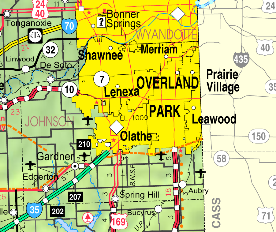
Samandráttur
| Frágreiðing | This map of Johnson County, Kansas, U.S., is copied at a resolution of 300 pixels/inch from the original PDF file. |
| Dagur | |
| Kelda | Kansas 2005–2006 Official Transportation Map [1] (map legend) |
| Høvundur | Designed and published by the Kansas Department of Transportation. |
| Loyvi (Endurnýtsla av hesi fílu) |
Lisensur
| This work has been released into the public domain by its author, Kansas Department of Transportation. This applies worldwide. In some countries this may not be legally possible; if so: Kansas Department of Transportation grants anyone the right to use this work for any purpose, without any conditions, unless such conditions are required by law.
|
This map is published by the Kansas Department of Transportation and is distributed to the public free of charge. KDOT makes no warranties, guarantees, or representations for accuracy of this information and assumes no liability for errors or omissions. Maps produced using tax payer dollars are free for public use.
Søgan hjá fíluni
Trýst á dato/tíð fyri at síggja fíluna, sum hon sá út tá.
| Dagur/Tíð | Lítil mynd | Dimensjónir | Brúkari | Viðmerking | |
|---|---|---|---|---|---|
| streymur | 27. mar 2006 kl. 01:37 | | 902 × 758 (308 KB) | Moverton | Source: Kansas 2005-2006 Official Transportation Map {{PD-US}} |
Myndarslóðir
Hesar síður slóða til hesa mynd:
Alheims fílunýtsla
Aðrar wkiir brúka hesa fílu:
- Nýtsla á azb.wikipedia.org
- د سوتو، کانزاس
- اولات، کانزاس
- ادجرتون، کانزاس
- اوورلاند پارک، کانزاس
- فایروای، کانزاس
- وزتوود هیلس، کانزاس
- وزتوود، کانزاس
- پرایری ویلئیج، کانزاس
- قاردنر، کانزاس
- رولاند پارک، کانزاس
- شاونی، کانزاس
- لیوود، کانزاس
- لئیک کویویرا، کانزاس
- ایسپرینق هیل، کانزاس
- مریام، کانزاس
- میسیون هیلس، کانزاس
- میسیون وودز، کانزاس
- میسیون، کانزاس
- Nýtsla á en.wikipedia.org
- Nýtsla á nl.wikipedia.org
- Nýtsla á simple.wikipedia.org
- Nýtsla á tt.wikipedia.org
- Nýtsla á ur.wikipedia.org
Vís meiri globala nýtslu av hesi fílu.