Mynd:LocationTonga.png
Ongin hægri upploysn varð funnin.
LocationTonga.png (250 × 158 pixel, stødd fílu: 6 KB, MIME-slag: image/png)
Samandráttur
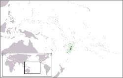
| Frágreiðing | Location map for Tonga | ||
| Dagur | |||
| Kelda | Egið verk | ||
| Høvundur | Created by: Vardion. Uploaded by: EugeneZelenko. | ||
| Loyvi (Endurnýtsla av hesi fílu) |
|
Søgan hjá fíluni
Trýst á dato/tíð fyri at síggja fíluna, sum hon sá út tá.
| Dagur/Tíð | Lítil mynd | Dimensjónir | Brúkari | Viðmerking | |
|---|---|---|---|---|---|
| streymur | 21. des 2004 kl. 15:15 | | 250 × 158 (6 KB) | EugeneZelenko | Location map for the Tonga.<br/>Originally created for English Wikipedia by Vardion.<br/>{{PD}}<br/>Category:Country locator maps |
Myndarslóðir
Hesar síður slóða til hesa mynd:
Alheims fílunýtsla
Aðrar wkiir brúka hesa fílu:
- Nýtsla á af.wikipedia.org
- Nýtsla á ar.wikipedia.org
- Nýtsla á arz.wikipedia.org
- Nýtsla á ban.wikipedia.org
- Nýtsla á ba.wikipedia.org
- Nýtsla á be-tarask.wikipedia.org
- Nýtsla á be.wikipedia.org
- Nýtsla á bg.wikipedia.org
- Nýtsla á bn.wikipedia.org
- Nýtsla á bo.wikipedia.org
- Nýtsla á bpy.wikipedia.org
- Nýtsla á bs.wikipedia.org
- Nýtsla á ca.wikipedia.org
- Nýtsla á ceb.wikipedia.org
- Nýtsla á chr.wikipedia.org
- Nýtsla á ckb.wikipedia.org
- Nýtsla á cs.wikipedia.org
- Nýtsla á cu.wikipedia.org
- Nýtsla á de.wikinews.org
- Nýtsla á de.wikivoyage.org
- Nýtsla á de.wiktionary.org
- Nýtsla á en.wikipedia.org
- Nýtsla á en.wikivoyage.org
- Nýtsla á eo.wikipedia.org
- Nýtsla á eo.wiktionary.org
- Nýtsla á es.wikipedia.org
- Nýtsla á ext.wikipedia.org
- Nýtsla á fa.wikipedia.org
- Nýtsla á fiu-vro.wikipedia.org
- Nýtsla á frp.wikipedia.org
Vís meiri globala nýtslu av hesi fílu.