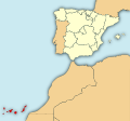
Mynd:Localización de la Región de Canarias.svg

Size of this PNG preview of this SVG file: 643 × 600 pixels. Aðrar upploysnir: 257 × 240 pixels | 515 × 480 pixels | 824 × 768 pixels | 1.098 × 1.024 pixels | 2.196 × 2.048 pixels | 799 × 745 pixels.
Upprunafíla (SVG fíle, nominelt 799 × 745 pixel, fíle stødd: 638 KB)
Søgan hjá fíluni
Trýst á dato/tíð fyri at síggja fíluna, sum hon sá út tá.
| Dagur/Tíð | Lítil mynd | Dimensjónir | Brúkari | Viðmerking | |
|---|---|---|---|---|---|
| streymur | 5. aug 2010 kl. 07:51 |  | 799 × 745 (638 KB) | Orionist | removed border and artifacts, various other fixes |
| 18. feb 2010 kl. 02:26 |  | 1.972 × 1.846 (723 KB) | Mircalla22 | {{Information |Description={{en|Map of Spain with the Canary Islands highlighted.}}{{es|Localización de Canarias respecto a España.}} }} |Source=*File:Localización_de_la_Región_de_Murcia.svg *[[:File:The |
Myndarslóðir
Hesar síður slóða til hesa mynd:
Alheims fílunýtsla
Aðrar wkiir brúka hesa fílu:
- Nýtsla á als.wikipedia.org
- Nýtsla á am.wikipedia.org
- Nýtsla á ast.wiktionary.org
- Nýtsla á ba.wikipedia.org
- Nýtsla á be-tarask.wikipedia.org
- Nýtsla á ca.wikipedia.org
- Nýtsla á cs.wikipedia.org
- Nýtsla á de.wikipedia.org
- Nýtsla á el.wikipedia.org
- Nýtsla á el.wiktionary.org
- Nýtsla á en.wikipedia.org
- Nýtsla á eo.wikipedia.org
- Nýtsla á es.wikipedia.org
- Nýtsla á frr.wikipedia.org
- Nýtsla á fr.wikipedia.org
- Nýtsla á fr.wikinews.org
- Nýtsla á gcr.wikipedia.org
- Nýtsla á he.wikivoyage.org
- Nýtsla á hy.wikipedia.org
- Nýtsla á ia.wikipedia.org
- Nýtsla á it.wikipedia.org
- Nýtsla á ky.wikipedia.org
- Nýtsla á lad.wikipedia.org
- Nýtsla á lij.wikipedia.org
- Nýtsla á lt.wikipedia.org
- Nýtsla á lv.wikipedia.org
- Nýtsla á mi.wikipedia.org
- Nýtsla á mn.wikipedia.org
- Nýtsla á mrj.wikipedia.org
- Nýtsla á mr.wikipedia.org
- Nýtsla á nap.wikipedia.org
- Nýtsla á nl.wikipedia.org
- Nýtsla á pl.wiktionary.org
Vís meiri globala nýtslu av hesi fílu.
