Mynd:Israel districts numbered.png

Stødd av hesi forskoðan: 223 × 599 pixels. Onnur upploysn: 304 × 816 pixels.
Upprunafíla (304 × 816 pixel, stødd fílu: 37 KB, MIME-slag: image/png)
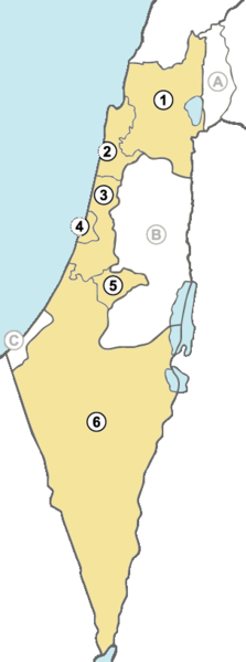
| Frágreiðing | Israel districts numbered | ||
| Dagur | |||
| Kelda | Egið verk | ||
| Høvundur | arz | ||
| Loyvi (Endurnýtsla av hesi fílu) |
|
||
| Other versions |
|
Søgan hjá fíluni
Trýst á dato/tíð fyri at síggja fíluna, sum hon sá út tá.
| Dagur/Tíð | Lítil mynd | Dimensjónir | Brúkari | Viðmerking | |
|---|---|---|---|---|---|
| streymur | 3. des 2010 kl. 02:20 | 304 × 816 (37 KB) | Bambuway | Distinct colours | |
| 17. okt 2010 kl. 23:10 | 304 × 816 (37 KB) | Bambuway | Coloured the sea | ||
| 17. okt 2010 kl. 21:33 | 304 × 816 (36 KB) | Bambuway | UNIFIL is not an Israeli district | ||
| 28. mar 2007 kl. 07:36 | 304 × 816 (54 KB) | Arz | {{Information |Description=Israel districts numbered |Source=own work |Date=March 28, 2007 |Author=arz |Permission={{PD-self}} |other_versions=50px SVG }} Category:Maps of Israel |
Myndarslóðir
Hesar síður slóða til hesa mynd:
Alheims fílunýtsla
Aðrar wkiir brúka hesa fílu:
- Nýtsla á ady.wikipedia.org
- Nýtsla á an.wikipedia.org
- Nýtsla á ar.wikipedia.org
- Nýtsla á arz.wikipedia.org
- Nýtsla á ast.wikipedia.org
- Nýtsla á be-tarask.wikipedia.org
- Nýtsla á bg.wikipedia.org
- Nýtsla á ce.wikipedia.org
- Nýtsla á cs.wikipedia.org
- Nýtsla á da.wikipedia.org
- Nýtsla á en.wikipedia.org
- Nýtsla á hy.wikipedia.org
- Nýtsla á id.wikipedia.org
- Nýtsla á it.wikipedia.org
- Nýtsla á kbd.wikipedia.org
- Nýtsla á no.wikipedia.org
- Nýtsla á pl.wikipedia.org
- Nýtsla á pt.wikipedia.org
- Nýtsla á ro.wikipedia.org
- Nýtsla á sk.wikipedia.org
- Nýtsla á uk.wikipedia.org
- Nýtsla á uz.wikipedia.org