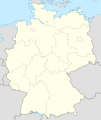
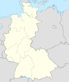
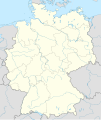
Mynd:Germany, location map (SBZ perspective) 23 May 1949 - 6 Oct 1949.svg

Upprunafíla (SVG fíle, nominelt 1.075 × 1.273 pixel, fíle stødd: 1,14 MB)
Henda fíla er frá Wikimedia Commons og kann verða brúka í øðrum verkætlanum. Frágreiðingin á fílu frágreiðingar síðu er víst her niðanfyri.
Samandráttur
| FrágreiðingGermany, location map (SBZ perspective) 23 May 1949 - 6 Oct 1949.svg |
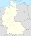
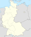
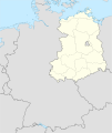
Deutsch: Positionskarte der Deutschland. Diese Karte zeigt Deutschland im Gebietsstand zwischen 23. Mai 1949 bis 6. Oktober 1949 aus Sicht der Deutschen in der SBZ.
Quadratische Plattkarte, N-S-Streckung 150 %. Geographische Begrenzung der Karte:
English: Location map of Germany. Map shows Germany as of May 23rd 1949 till October 6th 1949. Map shows the perspective of states in the soviet occupation zone.
Equirectangular projection, N/S stretching 150 %. Geographic limits of the map:
|
||
| Dagur | Created in 2010 | ||
| Kelda | own work, based on File:Germany location map 23 April 1949 - 22 May 1949.svg | ||
| Høvundur | TUBS | ||
| Loyvi (Endurnýtsla av hesi fílu) |
I, the copyright holder of this work, hereby publish it under the following licenses:
Henda fíla er gjørd atkomulig undir Creative Commons Navngev-Deil á sama hátt 3.0 Unported loyvinum.
Tú kanst velja tann lisens ið tú ynskir. |
||
| Other versions |
Bundesrepublik Deutschland (vor 1990 nur West-Deutschland):
Deutsche Demokratische Republik (mit BRD im Ausschnitt):
Ostdeutschland (vor 1990 Deutsche Demokratische Republik):
Deutschland zwischen Mai 1945 und Oktober 1949:
Thematisch:
Deutsches Reich (1918–1945) (best used with this template (de)):
|
Captions
Items portrayed in this file
depicts enskt
some value
copyright status enskt
copyrighted enskt
Søgan hjá fíluni
Trýst á dato/tíð fyri at síggja fíluna, sum hon sá út tá.
| Dagur/Tíð | Lítil mynd | Dimensjónir | Brúkari | Viðmerking | |
|---|---|---|---|---|---|
| streymur | 30. apr 2010 kl. 08:02 | 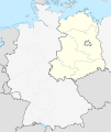 | 1.075 × 1.273 (1,14 MB) | TUBS | == {{int:filedesc}} == {{Information |Description= {{de|Positionskarte der Deutschland. Diese Karte zeigt Deutschland im Gebietsstand zwischen 23. Mai 1949 bis 6. Oktober 1949 aus Sicht der Deutschen in der SBZ.}} Quadratische Plattkar |
Myndarslóðir
Ongar síður slóða til hesa myndina.
Alheims fílunýtsla
Aðrar wkiir brúka hesa fílu:
- Nýtsla á en.wikipedia.org

