Mynd:Darlington map of Pennsylvania 1680.png
Stødd av hesi forskoðan: 800 × 497 pixels. Aðrar upploysnir: 320 × 199 pixels | 640 × 398 pixels | 1.084 × 674 pixels.
Upprunafíla (1.084 × 674 pixel, stødd fílu: 1,82 MB, MIME-slag: image/png)
Samandráttur
| Frágreiðing |
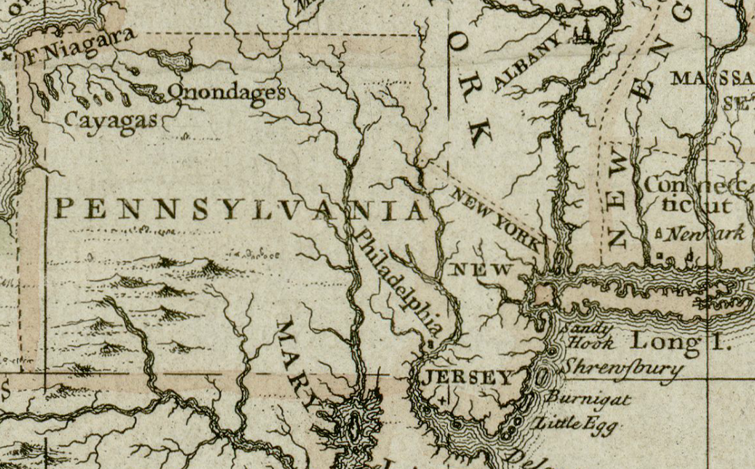
English: This is a section of a map that is part of the Darlington map collection housed in the Archives Service Center, University Library System, University of Pittsburgh, [1] Pittsburgh, PA US
The original map from which this portion was taken can be found here. |
| Dagur | |
| Kelda | The Darlington Collection of maps, Archives Service Center, University of Pittsburgh Library System, University of Pittsburgh |
| Høvundur | unknown mapmaker |
Lisensur
This work is in the public domain in the United States because it was published (or registered with the U.S. Copyright Office) before January 1, 1929.
Public domain works must be out of copyright in both the United States and in the source country of the work in order to be hosted on the Commons. If the work is not a U.S. work, the file must have an additional copyright tag indicating the copyright status in the source country.
Note: This tag should not be used for sound recordings. |
Søgan hjá fíluni
Trýst á dato/tíð fyri at síggja fíluna, sum hon sá út tá.
| Dagur/Tíð | Lítil mynd | Dimensjónir | Brúkari | Viðmerking | |
|---|---|---|---|---|---|
| streymur | 10. jun 2017 kl. 06:46 | | 1.084 × 674 (1,82 MB) | Barbara (WVS) | User created page with UploadWizard |
Myndarslóðir
Hesar síður slóða til hesa mynd:
Alheims fílunýtsla
Aðrar wkiir brúka hesa fílu:
- Nýtsla á en.wikipedia.org
- Nýtsla á fa.wikipedia.org
- Nýtsla á it.wikipedia.org