Mynd:Brazil State DistritoFederal.svg

Size of this PNG preview of this SVG file: 613 × 600 pixels. Aðrar upploysnir: 245 × 240 pixels | 490 × 480 pixels | 785 × 768 pixels | 1.046 × 1.024 pixels | 2.093 × 2.048 pixels | 702 × 687 pixels.
Upprunafíla (SVG fíle, nominelt 702 × 687 pixel, fíle stødd: 676 KB)

|
Standardization of derivative maps
Feel free to create derivations of this work, but if you want to illustrate a Wikipedia article with derivative works of this or similar maps of Brazil, please strictly follow the visual standard, nomenclature and classification already in use. All maps of Brazilian subdivisions are being adaptated or created in this way. We do not want to inhibit creativity but the pattern adopted here was presented and accepted by the Lusophone community and should be followed whenever possible. |
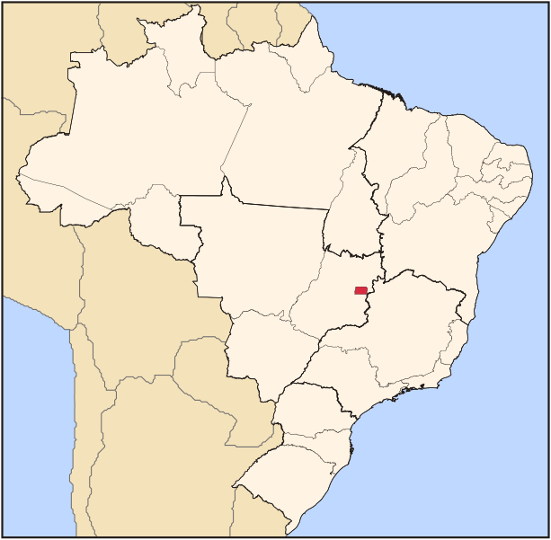
| Frágreiðing | Map locator of Brazil's Distrito Federal (Federal District) | ||||||||
| Dagur | |||||||||
| Kelda | Egið verk | ||||||||
| Høvundur | Raphael Lorenzeto de Abreu | ||||||||
| Loyvi (Endurnýtsla av hesi fílu) |
I, the copyright holder of this work, hereby publish it under the following licenses:
This file is licensed under the Creative Commons Attribution 2.5 Generic license.
Tú kanst velja tann lisens ið tú ynskir. |

Søgan hjá fíluni
Trýst á dato/tíð fyri at síggja fíluna, sum hon sá út tá.
| Dagur/Tíð | Lítil mynd | Dimensjónir | Brúkari | Viðmerking | |
|---|---|---|---|---|---|
| streymur | 3. jun 2006 kl. 03:10 | | 702 × 687 (676 KB) | Raphael.lorenzeto | |
| 22. apr 2006 kl. 02:54 |  | 702 × 687 (448 KB) | Raphael.lorenzeto | {{Information| |Description=Map locator of Brazil's Distrito Federal (Federal District) |Source=own work |Date=April, 21 2006 |Author=Raphael Lorenzeto de Abreu |Permission={{self2|GFDL|cc-by-2.5}} |other_versions= }} Category:Maps of Brazil |
Myndarslóðir
Hesar síður slóða til hesa mynd:
Alheims fílunýtsla
Aðrar wkiir brúka hesa fílu:
- Nýtsla á af.wikipedia.org
- Nýtsla á als.wikipedia.org
- Nýtsla á ar.wikipedia.org
- Nýtsla á arz.wikipedia.org
- Nýtsla á ast.wikipedia.org
- Nýtsla á ay.wikipedia.org
- Nýtsla á bg.wikipedia.org
- Nýtsla á bpy.wikipedia.org
- Nýtsla á bs.wikipedia.org
- Nýtsla á ca.wikipedia.org
- Nýtsla á cs.wikipedia.org
- Nýtsla á da.wikipedia.org
- Nýtsla á de.wikipedia.org
- Nýtsla á diq.wikipedia.org
- Nýtsla á el.wikipedia.org
- Nýtsla á en.wikipedia.org
- Nýtsla á en.wiktionary.org
- Nýtsla á eu.wikipedia.org
- Nýtsla á fa.wikipedia.org
- Nýtsla á fr.wikipedia.org
- Nýtsla á fr.wikivoyage.org
- Nýtsla á fy.wikipedia.org
- Nýtsla á ga.wikipedia.org
- Nýtsla á gd.wikipedia.org
- Nýtsla á gl.wikipedia.org
- Nýtsla á gn.wikipedia.org
- Nýtsla á ha.wikipedia.org
- Nýtsla á hr.wikipedia.org
- Nýtsla á ht.wikipedia.org
- Nýtsla á ia.wikipedia.org
- Nýtsla á incubator.wikimedia.org
- Nýtsla á is.wikipedia.org
- Nýtsla á it.wikipedia.org
- Nýtsla á ja.wikipedia.org
- Nýtsla á ja.wiktionary.org
- Nýtsla á kab.wikipedia.org
- Nýtsla á ka.wikipedia.org
- Nýtsla á ko.wikipedia.org
- Nýtsla á kw.wikipedia.org
- Nýtsla á la.wikipedia.org
Vís meiri globala nýtslu av hesi fílu.