Mynd:Austria relief location map.jpg

Stødd av hesi forskoðan: 800 × 446 pixels. Aðrar upploysnir: 320 × 178 pixels | 640 × 357 pixels | 1.256 × 700 pixels.
Upprunafíla (1.256 × 700 pixel, stødd fílu: 677 KB, MIME-slag: image/jpeg)
Samandráttur
| Frágreiðing |
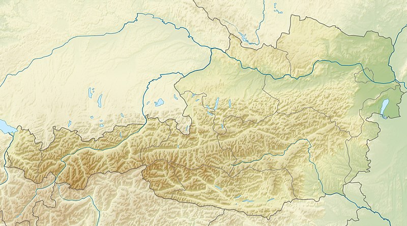
English: Location map of Austria
Equirectangular projection, N/S stretching 150 %. Geographic limits of the map:
|
| Dagur | |
| Kelda | Egið verk |
| Høvundur | Uwe Dedering |
| Other versions |
Derivative works of this file: ÖRF 2011.png
|

Lisensur
I, the copyright holder of this work, hereby publish it under the following licenses:
Henda fíla er gjørd atkomulig undir Creative Commons Navngev-Deil á sama hátt 3.0 Unported loyvinum.
- Tú ert vælkomin til:
- at deila – at avrita, breiða út og senda verkið
- at remiksa – at tillaga ella broyta verkið
- Undir hesum treytum:
- ognan – Tú mást ognarskrivað verkið á ein slíkan hátt sum er útgreinaður av høvundanum ella lisenseigaranum (men ikki á nakran hátt ið kundi bent á at hesin hevur góðkent teg ella tína nýtslu av verkinum).
- deil undir somu treytum – Um tú broytir, evnar til ella byggir víðari á hetta verk, so kanst tú bert útgeva verkið undir somu ella líkandi lisensi sum hesin.

|
Loyvi verður givi at avrita, bera út og/ella broyta hetta skjal undir treytunum hjá GNU Free Documentation License, versión 1.2 ella einhvør seinni versjón ið er útgivin av Free Software Foundation; uttan nakað óbroytiligt brot, uttan forsíðutekst og uttan baksíðutekst. Eitt avrit av loyvinum er tikið við í brotinum ið nevnist GNU Free Documentation License. |
Tú kanst velja tann lisens ið tú ynskir.

|
This map image could be re-created using vector graphics as an SVG file. This has several advantages; see Commons:Media for cleanup for more information. If an SVG form of this image is available, please upload it and afterwards replace this template with
{{vector version available|new image name}}.
It is recommended to name the SVG file “Austria relief location map.svg”—then the template Vector version available (or Vva) does not need the new image name parameter. |


Søgan hjá fíluni
Trýst á dato/tíð fyri at síggja fíluna, sum hon sá út tá.
| Dagur/Tíð | Lítil mynd | Dimensjónir | Brúkari | Viðmerking | |
|---|---|---|---|---|---|
| streymur | 28. jun 2010 kl. 09:14 | | 1.256 × 700 (677 KB) | Uwe Dedering | very little border change |
| 26. apr 2010 kl. 12:24 |  | 1.256 × 700 (677 KB) | Uwe Dedering | rhine | |
| 24. apr 2010 kl. 12:54 |  | 1.256 × 700 (676 KB) | Uwe Dedering | {{Information |Description={{en|1=Location map of Austria}} Equirectangular projection, N/S stretching 150 %. Geographic limits of the map: * N: 49.2° N * S: 46.3° N * W: 9.4° E * E: 17.2° E Made with Natural Earth. Free |
Myndarslóðir
Hesar síður slóða til hesa mynd:
Alheims fílunýtsla
Aðrar wkiir brúka hesa fílu:
- Nýtsla á ab.wikipedia.org
- Nýtsla á als.wikipedia.org
- Nýtsla á am.wikipedia.org
- Nýtsla á an.wikipedia.org
- Nýtsla á ar.wikipedia.org
- Nýtsla á arz.wikipedia.org
- Nýtsla á ast.wikipedia.org
- Nýtsla á as.wikipedia.org
- Nýtsla á azb.wikipedia.org
- Nýtsla á az.wikipedia.org
- Nýtsla á ban.wikipedia.org
- Nýtsla á ba.wikipedia.org
- Nýtsla á be-tarask.wikipedia.org
- Nýtsla á be.wikipedia.org
- Nýtsla á bh.wikipedia.org
- Nýtsla á bn.wikipedia.org
Vís meiri globala nýtslu av hesi fílu.