Mynd:Algeria Map.jpg
Stødd av hesi forskoðan: 500 × 600 pixels. Aðrar upploysnir: 200 × 240 pixels | 400 × 480 pixels | 640 × 768 pixels | 1.032 × 1.238 pixels.
Upprunafíla (1.032 × 1.238 pixel, stødd fílu: 240 KB, MIME-slag: image/jpeg)
Samandráttur
| Frágreiðing |
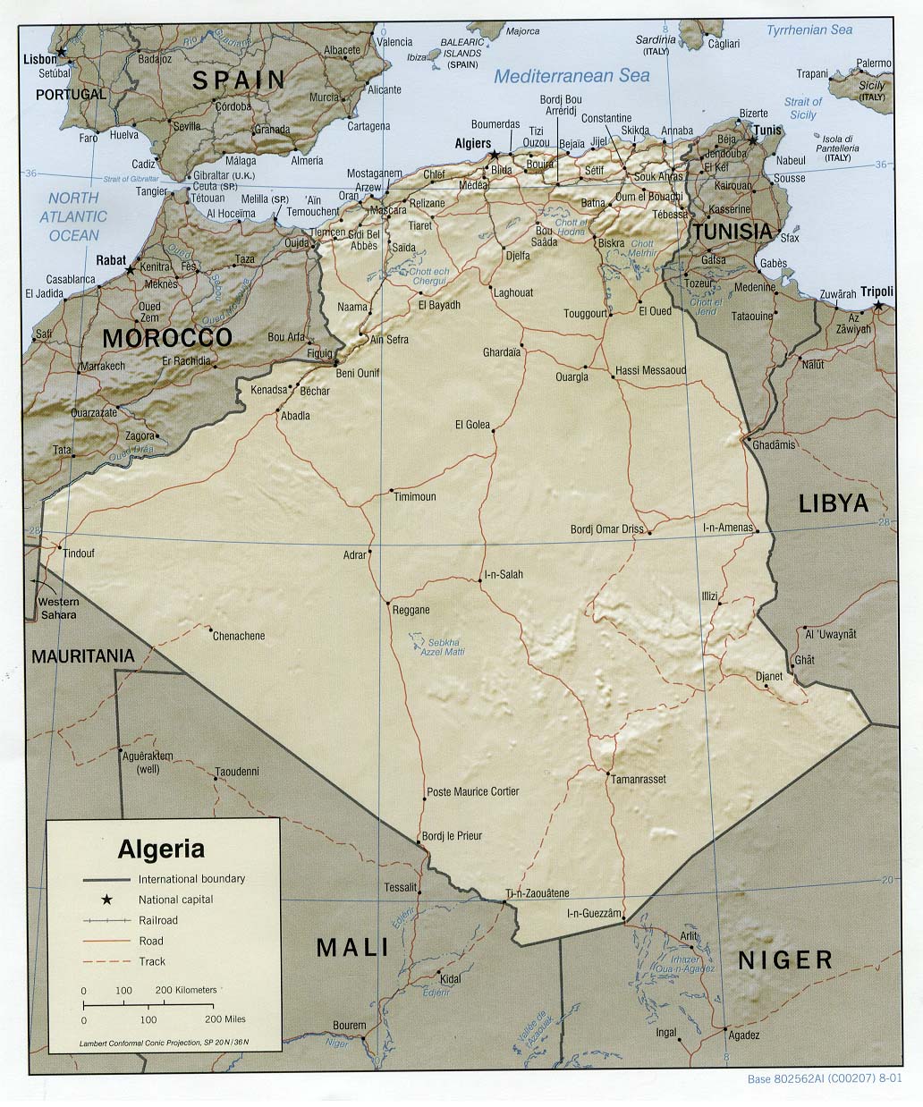
العربية: خريطة الجزائر المساعدة والمظللة، 2001. English: Shaded relief map of Algeria, 2001. |
| Dagur | |
| Kelda |
University of Texas Libraries, Perry-Castañeda Library Map Collection: Algeria Maps |
| Høvundur | CIA |
Lisensur
| This image is a work of a Central Intelligence Agency employee, taken or made as part of that person's official duties. As a Work of the United States Government, this image or media is in the public domain in the United States.
|

|
Søgan hjá fíluni
Trýst á dato/tíð fyri at síggja fíluna, sum hon sá út tá.
| Dagur/Tíð | Lítil mynd | Dimensjónir | Brúkari | Viðmerking | |
|---|---|---|---|---|---|
| streymur | 21. feb 2006 kl. 11:28 | | 1.032 × 1.238 (240 KB) | Lupo | Shaded relief map of Algeria. Source: [http://www.lib.utexas.edu/maps/africa/algeria_rel01.jpg] from the [http://www.lib.utexas.edu/maps/algeria.html Perry-Castañeda Library Map Collection]. {{PD-USGov-CIA}} Category:Maps of Algeria |
Myndarslóðir
Hesar síður slóða til hesa mynd:
Alheims fílunýtsla
Aðrar wkiir brúka hesa fílu:
- Nýtsla á als.wikipedia.org
- Nýtsla á ar.wikipedia.org
- Nýtsla á azb.wikipedia.org
- Nýtsla á de.wikipedia.org
- Nýtsla á de.wiktionary.org
- Nýtsla á el.wikipedia.org
- Nýtsla á en.wikipedia.org
- Nýtsla á eo.wikipedia.org
- Nýtsla á frr.wikipedia.org
- Nýtsla á fr.wikipedia.org
- Nýtsla á hr.wiktionary.org
- Nýtsla á hu.wikipedia.org
- Nýtsla á hu.wiktionary.org
- Nýtsla á incubator.wikimedia.org
- Nýtsla á it.wikipedia.org
- Nýtsla á lb.wikipedia.org
- Nýtsla á ms.wikipedia.org
- Nýtsla á no.wikipedia.org
- Nýtsla á no.wikinews.org
- Nýtsla á ru.wikipedia.org
- Nýtsla á sd.wikipedia.org
- Nýtsla á sl.wikipedia.org
- Nýtsla á szy.wikipedia.org
- Nýtsla á uk.wikipedia.org
- Nýtsla á ur.wikipedia.org
- Nýtsla á vi.wikipedia.org
- Nýtsla á www.wikidata.org
- Nýtsla á zh.wikipedia.org