Mynd:Topographic map of Okinawa Island.png
Upprunafíla (1.117 × 1.345 pixel, stødd fílu: 1,04 MB, MIME-slag: image/png)
Samandráttur
| Frágreiðing |
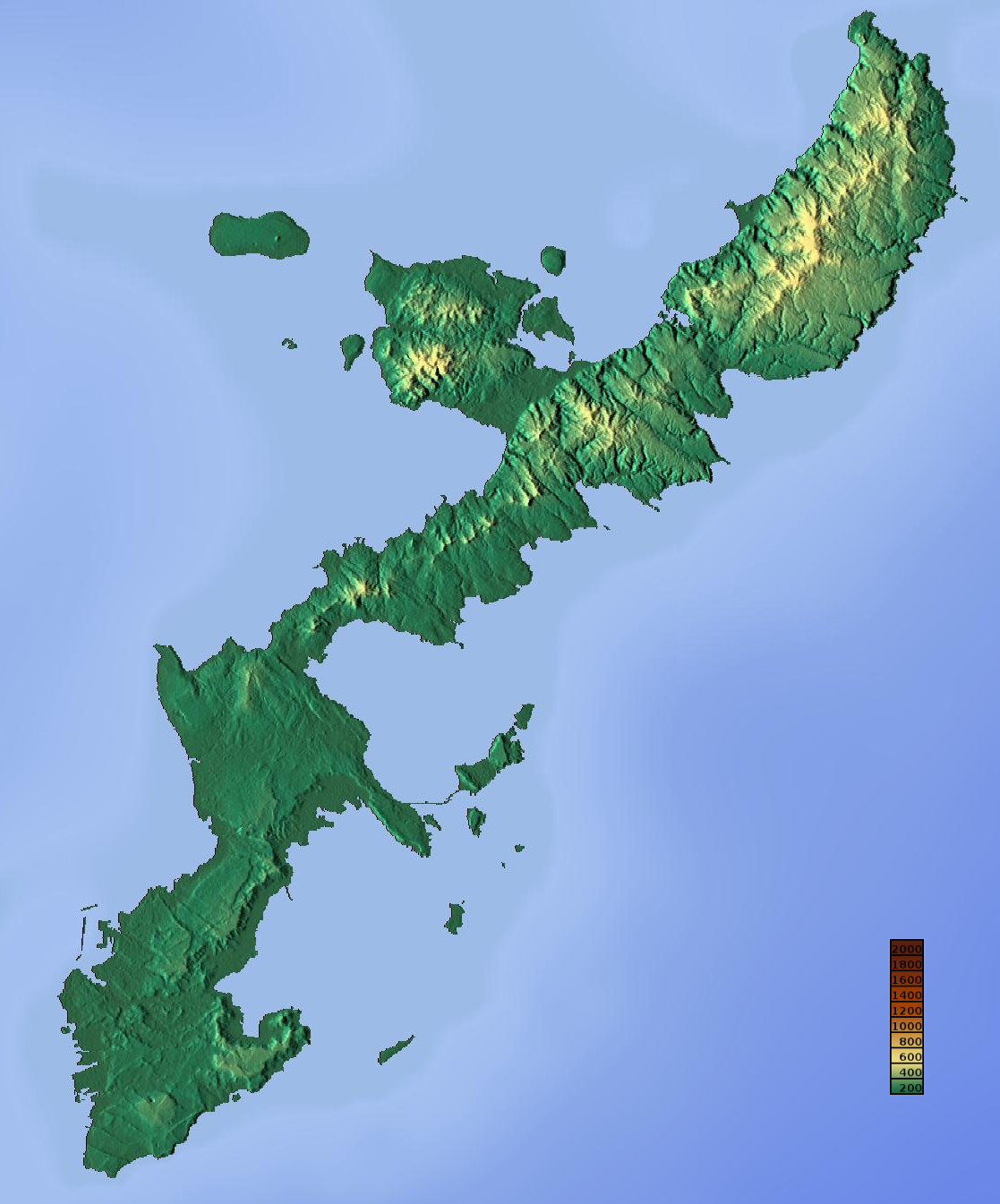
English: Topographic map of Okinawa Island.
日本語: 沖縄島の地形図 |
| Dagur | |
| Kelda | http://www.maps-for-free.com/ |
| Høvundur | Retouched by Kugel~commonswiki |
| Loyvi (Endurnýtsla av hesi fílu) |
http://www.maps-for-free.com/html/about.html |
| Other versions |
|

Lisensur
This screenshot either does not contain copyright-eligible parts or visuals of copyrighted software, or the author has released it under a free license (which should be indicated beneath this notice), and as such follows the licensing guidelines for screenshots of Wikimedia Commons. You may use it freely according to its particular license. Free software license:

|
This work is free software; you can redistribute it and/or modify it under the terms of the GNU General Public License as published by the Free Software Foundation; either version 2 of the License, or any later version. This work is distributed in the hope that it will be useful, but without any warranty; without even the implied warranty of merchantability or fitness for a particular purpose. See version 2 and version 3 of the GNU General Public License for more details. |
Note: if the screenshot shows any work that is not a direct result of the program code itself, such as a text or graphics that are not part of the program, the license for that work must be indicated separately.
| This file is made available under the Creative Commons CC0 1.0 Universal Public Domain Dedication. | |
| The person who associated a work with this deed has dedicated the work to the public domain by waiving all of their rights to the work worldwide under copyright law, including all related and neighboring rights, to the extent allowed by law. You can copy, modify, distribute and perform the work, even for commercial purposes, all without asking permission.
|
Søgan hjá fíluni
Trýst á dato/tíð fyri at síggja fíluna, sum hon sá út tá.
| Dagur/Tíð | Lítil mynd | Dimensjónir | Brúkari | Viðmerking | |
|---|---|---|---|---|---|
| streymur | 8. mai 2014 kl. 05:53 | | 1.117 × 1.345 (1,04 MB) | Kugel~commonswiki | {{Information |Description ={{en|1=Topographic map of Okinawa Island.}} {{ja|1=沖縄島の地形図}} |Source =http://www.maps-for-free.com/ |Author =Retouched by Kugel |Date =2014-05-08 |Permission =htt... |
Myndarslóðir
Hesar síður slóða til hesa mynd:
Alheims fílunýtsla
Aðrar wkiir brúka hesa fílu:
- Nýtsla á ar.wikipedia.org
- Nýtsla á en.wikipedia.org
- Nýtsla á hu.wikipedia.org
- Nýtsla á incubator.wikimedia.org
- Nýtsla á ja.wikipedia.org
- Nýtsla á ko.wikipedia.org
- Nýtsla á no.wikipedia.org
- Nýtsla á www.wikidata.org
- Nýtsla á wuu.wikipedia.org