Mynd:I-80 Eastshore Fwy.jpg

Stødd av hesi forskoðan: 800 × 576 pixels. Aðrar upploysnir: 320 × 230 pixels | 640 × 461 pixels | 1.024 × 737 pixels | 1.280 × 922 pixels | 1.600 × 1.152 pixels.
Upprunafíla (1.600 × 1.152 pixel, stødd fílu: 304 KB, MIME-slag: image/jpeg)
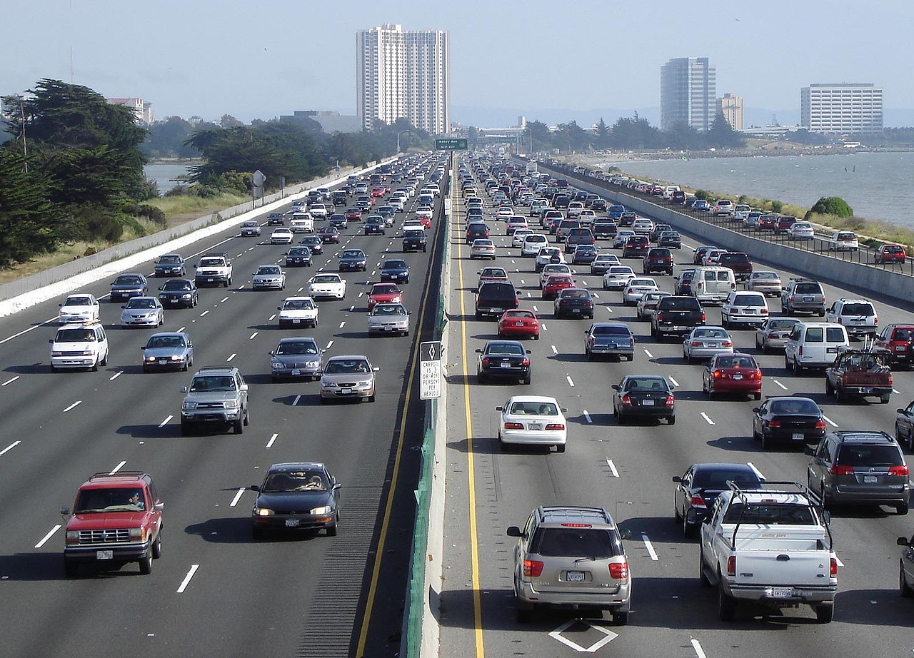
| Frágreiðing | Looking south above en:Interstate 80, the Eastshore Freeway, near en:Berkeley, California on a Saturday afternoon. en:Emeryville, California is at the towers, en:Aquatic Park (Berkeley) is visible to the left. To the right is the east shore of the en:San Francisco Bay. Picture taken by Minesweeper on May 14, 2005. |
| Kelda | Minesweeper |
| Høvundur | User Minesweeper on en.wikipedia |
| Loyvi (Endurnýtsla av hesi fílu) |
Released under the GNU Free Documentation License. |
| Other versions |
Originally from en.wikipedia; description page is (was) here * 10:17, 15 May 2005 [[:en:User:Minesweeper|Minesweeper]] 1600×1152 (311,297 bytes) <span class="comment">(Looking south above Interstate 80, the Eastshore Freeway, near Berkeley, California on a Saturday afternoon. Picture taken by me on May 14, 2005. {{GFDL}})</span> |
| Camera location | | View this and other nearby images on: OpenStreetMap |
|---|

|
Loyvi verður givi at avrita, bera út og/ella broyta hetta skjal undir treytunum hjá GNU Free Documentation License, versión 1.2 ella einhvør seinni versjón ið er útgivin av Free Software Foundation; uttan nakað óbroytiligt brot, uttan forsíðutekst og uttan baksíðutekst. Eitt avrit av loyvinum er tikið við í brotinum ið nevnist GNU Free Documentation License. |
| Henda fíla er gjørd atkomulig undir Creative Commons Navngev-Deil á sama hátt 3.0 Unported loyvinum. | ||
| ||
| This licensing tag was added to this file as part of the GFDL licensing update. |
(Uploaded using CommonsHelper or PushForCommons)
Søgan hjá fíluni
Trýst á dato/tíð fyri at síggja fíluna, sum hon sá út tá.
| Dagur/Tíð | Lítil mynd | Dimensjónir | Brúkari | Viðmerking | |
|---|---|---|---|---|---|
| streymur | 23. okt 2006 kl. 04:28 | | 1.600 × 1.152 (304 KB) | Zzyzx11 | {{Information| |Description= Looking south above en:Interstate 80, the Eastshore Freeway, near en:Berkeley, California on a Saturday afternoon. Picture taken by Minesweeper on May 14, 2005. |Source= |Date= |Author=User |
Myndarslóðir
Hesar síður slóða til hesa mynd:
Alheims fílunýtsla
Aðrar wkiir brúka hesa fílu:
- Nýtsla á af.wikipedia.org
- Nýtsla á als.wikipedia.org
- Nýtsla á ar.wikipedia.org
- Nýtsla á ar.wiktionary.org
- Nýtsla á ast.wikipedia.org
- Nýtsla á az.wikipedia.org
- Nýtsla á be.wikipedia.org
- Nýtsla á bg.wikipedia.org
- Nýtsla á bh.wikipedia.org
- Nýtsla á bn.wikipedia.org
- Nýtsla á br.wikipedia.org
- Nýtsla á bs.wikipedia.org
- Nýtsla á ca.wikipedia.org
- Nýtsla á cdo.wikipedia.org
- Nýtsla á cv.wikipedia.org
- Nýtsla á cy.wikipedia.org
- Nýtsla á da.wikipedia.org
- Nýtsla á de.wikipedia.org
- Nýtsla á de.wikibooks.org
- Nýtsla á el.wikipedia.org
- Nýtsla á en.wikipedia.org
Vís meiri globala nýtslu av hesi fílu.